Last updated: October 2026
Most capital cities have a big park. Seoul has a national park. With granite peaks. And steel cables. And a 300-year-old fortress wall snaking over the ridges. All of it reachable by subway.

Bukhansan is the mountain every Seoul hiker eventually has to climb, and its summit, Baegundae (836.5 m), is the highest point in the city. This guide covers the best routes with my own English maps, what the cable section is really like, gear rental, and where to eat pajeon afterward. For the big picture of Seoul hikes, start with my 8 Best Hikes in Seoul.
⚡ TL;DR: Shortest summit route: the Doseonsa route from Bukhansan Ui Station, 1.9 km of trail, about 1.5 hours up. Most scenic: the Bukhansanseong route via the old fortress gate, 3.4 km, about 2 hours 40 up. The last stretch is bare granite with steel cables: real shoes, gloves, dry weather. Go on a weekday morning.
Bukhansan at a glance
| Highest peak | Baegundae, 836.5 m. A Korean flag flies on top all year. |
| Park | Bukhansan National Park, Korea’s 15th national park (1983), 76.9 km² |
| Two halves | Uiryeong pass splits it: Bukhansan in the south, Dobongsan in the north |
| Famous for | Granite peaks Baegundae, Insubong and Mangyeongdae; Bukhansanseong fortress; about 100 temples and hermitages |
| Entrance fee | Free |
| Nearest stations | Bukhansan Ui (Ui-Sinseol Line), Gupabal (Line 3) |

🔥 Hot take: Bukhansan is the only mountain I know where you can be clinging to a steel cable above the city at 10am and eating cheesecake in Seongsu by 3pm.
Which route should you take?
| Route | Start | Trail (one way) | Vibe |
|---|---|---|---|
| ① Doseonsa route | Bukhansan Ui Stn | 1.9 km · ~1.5 hrs | Shortest, steepest, most popular |
| ② Bukhansanseong route | Gupabal Stn + bus 704 | 3.4 km · ~2 hrs 40 | Fortress gate, valley, more variety |
| ③ Bibong & Samobawi | Gugi-dong, Jongno | 2.0 km · ~1 hr to Bibong | Southern ridge, history, big rocks |
| ④ Bukhansan Dulle-gil | Many points | 1–3 hrs per section | Gentle loop around the park, no summit |
Distances and one-way times are the Korea National Park Service’s official figures. Add breaks and the return trip.
Route ① The Doseonsa route (shortest way to the top)

This is how most locals bag Baegundae. From Bukhansan Ui Station, it’s about 2 km uphill along the road past Ui valley to Doseon Plaza near Doseonsa temple, where the real trail starts. Many people take a taxi this part to save their legs.


| Section | Distance | Time |
|---|---|---|
| Ui ranger post → Doseon Plaza (road) | 2.0 km | 30 min |
| Baegundae Trail Center → Harujae | 0.8 km | 30 min |
| Harujae → Baegundae Shelter | 0.6 km | 40 min |
| Baegundae Shelter → Baegundae summit | 0.5 km | 20 min |


- Harujae is the first ridge pass. Catch your breath and look up: the giant granite dome is Insubong, Korea’s most famous rock-climbing wall.
- Just off the trail sits Insuam, a tiny hermitage tucked under Insubong. Quiet, photogenic, and a good water stop.
- Baegundae Shelter (the old Baegun Sanjang hut, about 100 years old) is now a small museum about Korean mountaineering.
- Pass through Baegunbong Amun, an old fortress gate, then the final scramble on bare rock with steel cables.


🤫 Friend tip: Go up one way and down the other. Climb the Doseonsa route and descend to Bukhansanseong (or the reverse) and you’ll see twice as much mountain. Just make sure you know which bus or subway takes you home.
Route ② The Bukhansanseong route (the scenic one)

From Gupabal Station (Line 3), take bus 704 about 15 minutes to the Bukhansanseong Trail Center (there’s a big parking lot too). The trail starts easy on a paved road, follows a valley past Daeseomun, the west gate of the 1711 fortress, then turns into steep stone steps after Borisa temple.
| Section | Distance | Time |
|---|---|---|
| Bukhansanseong Trail Center → Daeseomun | 0.8 km | 30 min |
| Daeseomun → Borisa | 1.1 km | 40 min |
| Borisa → Baegundae summit | 1.5 km | 1 hr 30 |


Route ③ Bibong & Samobawi (the southern ridge)

Not after the summit? The southern ridge is a fantastic half-day with fewer people. From the Bibong Trail Center in Gugi-dong, climb past Geumseonsa temple to Bibong peak (2.0 km, about 1 hour). On top stands a replica of the Silla King Jinheung monument, a 1,400-year-old stone stele. The original is now in the National Museum of Korea.
From Bibong, follow the ridge to Samobawi, a huge box-shaped boulder said to look like an old official’s hat. Longer option: start at Gugi Trail Center and go up the valley via Daenammun gate to Samobawi (4.3 km, about 2.5 hours one way).


Route ④ Bukhansan Dulle-gil (the easy loop)
The Dulle-gil is a long, gentle trail that circles the whole park in sections. No summits, lots of forest, villages and valleys. Good for a rest day or a family walk. The Uiryeong-gil section between Bukhansan and Dobongsan is a quiet unpaved path of about 6.4 km (around 2 hours) that requires an advance reservation.
The cable section: how scary is it?
Exciting, not terrifying, if conditions are good. The final part of Baegundae is smooth, sloping granite with steel cables and rails the whole way. On busy days you’ll be in a slow line of people doing exactly the same thing.


- Wear proper hiking shoes with grippy soles. Sneakers slide on polished granite.
- Bring gloves. The cables get cold, and gloves improve your grip.
- Skip it when wet or icy. In winter, crampons are a must.
- Stay on the marked trail. The areas around Baegundae have fall and lightning risk, and rangers close sections in bad weather.
- Be patient on weekends. The summit is small and there’s often a queue for the flag photo.
🙅 Skip: rushing the cable section in sneakers to beat the sunset.
👉 Do this instead: turn around at Baegundae Shelter or the Baegunbong gate if you’re short on time or the rock is wet. The views are already fantastic there.
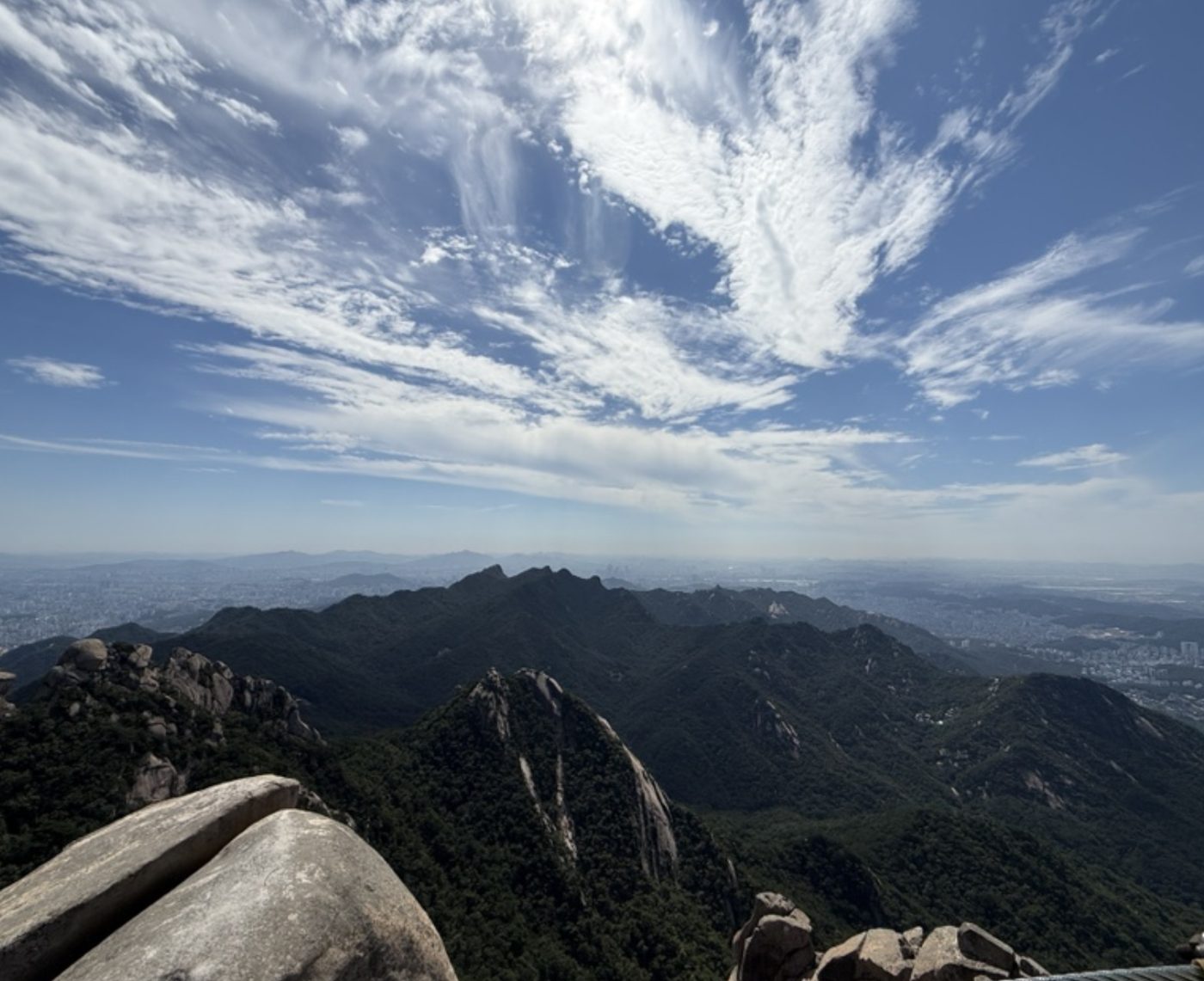
The view from the top


No gear? Rent it at the foot of the mountain
The Bukhansan Hiking Tourism Center is about 5 minutes from Bukhansan Ui Station, Exit 2. Foreign visitors can rent hiking shoes, clothes, backpacks, gloves and trekking poles at low prices, and get route advice in English, Chinese and Japanese.
- Hours: 09:00–18:00. Closed Mondays and on Seollal and Chuseok days.
- Booking: reservations on the official Seoul Hiking site (seoulhiking.or.kr).
- Hours and rental items can change, so check before you go.
Before you go: rules and safety
- Entry hours are restricted. National park trails have set entry times (earlier cut-offs in winter) and close around sunset. Start in the morning.
- Check closures. Sections close for repairs or weather. The Baegunbong gate to summit section, for example, reopened in October 2026 after a closure. Check the KNPS website before you go.
- Wildfire season. No smoking or cooking anywhere in the park. Fines are serious.
- Wild boar. Some trails are marked for boar caution. Keep your distance and don’t feed wildlife.
- Official info: Korea National Park Service publishes a free English Bukhansan guide (PDF) in its guide materials library (KNPS copyright policy).
When to go
| Season | What to expect |
|---|---|
| Spring | Azaleas and fresh green. Some trails close during spring wildfire season. |
| Summer | Green and humid. Start very early, bring lots of water, avoid the rock after rain. |
| Fall (Oct–Nov) | The best season. Red and gold valleys, crisp air, biggest crowds. |
| Winter | Snow on the granite looks amazing. Crampons are mandatory on the upper trail. |
Eat like a Korean hiker afterward
Both trailheads are lined with restaurants made for hungry hikers. On the Ui side, look for pajeon (scallion pancake) and a bottle of makgeolli. In Bukhansanseong village, there’s everything from pajeon to grilled duck and tofu stews. It’s the most important part of the hike. Do not skip it.
Bukhansan hiking checklist
- Hiking shoes with grip (or rent them)
- Gloves for the cables
- At least 1–1.5 liters of water per person
- Snacks or gimbap from a convenience store
- A warm layer and windbreaker. The summit is windy even in summer.
- Charged phone with data (see my eSIM guide)
- Crampons in winter
FAQ
How long does it take to hike Bukhansan?
On the Doseonsa route, the trail from Baegundae Trail Center to the summit is 1.9 km and takes about 1.5 hours up. Add about 30 minutes from Bukhansan Ui Station to the trailhead, and plan 3.5–5 hours round trip with breaks.
Is Bukhansan hard for beginners?
It’s a real mountain hike with steep stone steps and a cable-assisted rock section at the top. Fit beginners can do it in good weather with proper shoes. If you’re unsure, try Inwangsan first.
Do I need to pay to enter Bukhansan National Park?
No. Entry to Bukhansan National Park is free.
How do I get to Bukhansan by subway?
For the Doseonsa route, take the Ui-Sinseol Line to Bukhansan Ui Station. For the Bukhansanseong route, take Line 3 to Gupabal Station and then bus 704 to Bukhansanseong Trail Center.
Can I climb Insubong?
Only as a roped technical rock climb with proper gear and experience. Hikers go to Baegundae next door instead.
Did you make it to Baegundae? Tell me which route you took in the comments. Next up in this series: Dobongsan, Bukhansan’s rocky neighbor.
Trail conditions, closures, bus routes and center hours can change. Check the Korea National Park Service and official Seoul tourism sources before you go. Route maps are simplified illustrations by Seoul Friend, not to scale.
Photo credits
Unknown author / Public domain · Lcarrion88 / CC BY-SA 4.0 · Olga Lipunova / CC BY-SA 3.0 · Olga Lipunova / CC BY-SA 3.0 · National Museum of Korea / KOGL Type 1
👋 Written by Brian. A Seoul-based physician who performs aesthetic skin treatments, and a Seoul local for 30+ years. I’ve traveled much of Korea, spent two months living in Jeju, cook at home a lot and will happily cross the city for one good bowl of noodles. More about me →
Leave a Reply