Last updated: November 2026
⚡ TL;DR: Inwangsan (338 m) is the best short hike in central Seoul: about 1.5–2.5 hours, right next to Gyeongbokgung, with the old Seoul City Wall running up its spine, a shamanist shrine and Zen Rock (Seonbawi) on the way, and one of the best sunset and night views in the city. Start at Dongnimmun Station, Exit 2. It’s steep and rocky near the top, so wear real shoes.
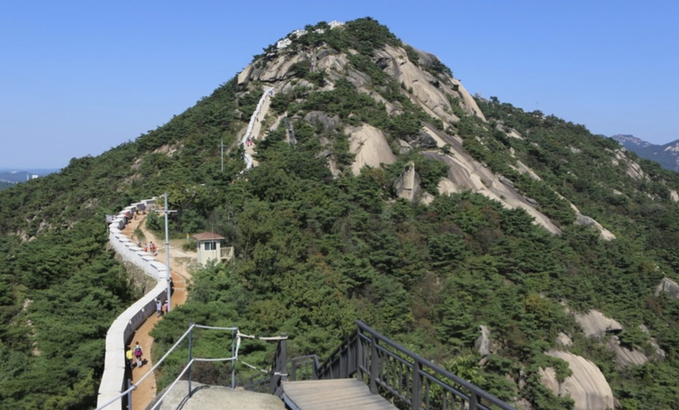
Every Seoul local has a “small mountain” they love, and Inwangsan is mine. It’s barely 340 meters high, you can see it from Gyeongbokgung Palace, and yet from the top it feels like you’re standing on the roof of Seoul: the palace below you, Bukhansan behind, N Seoul Tower across the city, and the old city wall snaking along the ridge.
I’ve climbed it at sunrise, on snowy mornings and after work in summer. Here’s how to do it right, whether you want a real workout or an easy forest walk.

Inwangsan at a glance
| Height | About 338 m |
| Time | 1.5–2.5 hours, depending on route |
| Difficulty | Easy to moderate; steep stone steps near the top |
| Best start | Dongnimmun Station (Line 3), Exit 2 |
| Best for | Sunset, night views, city wall history, a short real hike |
| Cost | Free, open 24 hours |

The best routes
Route 1: The classic (shrine, Zen Rock and the city wall)
Dongnimmun Station Exit 2 → Guksadang Shrine → Seonbawi (Zen Rock) → city wall steps → summit → down to Changuimun Gate / Yun Dong-ju Hill. About 2–2.5 hours.

You walk up through a hillside neighborhood to Guksadang, a shamanist shrine where you may hear drums or see a ceremony. Just above sits Seonbawi, a huge weathered rock that looks like two monks in robes, and a popular spot for prayers. From here, join the city wall and climb the stone steps to the summit. Be respectful at the shrine: keep your voice down and don’t photograph people praying.

Route 2: The easy forest walk
Gyeongbokgung Station Exit 3 → Jongno Town Bus 09 to the end → Suseong-dong Valley → Inwangsan forest trail → Yun Dong-ju Hill. About 1–1.5 hours, mostly gentle.

This route skips the summit and follows the forested lower slopes instead, with boardwalk sections and great views of the city. Suseong-dong Valley is a pretty little stream gorge that Korean painters have loved for centuries.
Route 3: Short and steep from Sajikdan
Gyeongbokgung Station Exit 1 → Sajik Park → follow the city wall straight up → summit. About 1.5 hours round trip. The most direct way up, with lots of stairs.

🔥 Hot take: Inwangsan at sunset beats paying for an observation deck. The view toward N Seoul Tower and the palace with the city lights coming on is free, and you earned it.
Sunset and night hiking
- Reach the summit about 30 minutes before sunset, then watch the city lights come on
- Bring a headlamp or phone light; the wall steps are uneven in the dark
- Go down the same way you came, or the gentler way toward Yun Dong-ju Hill
- In winter, rocks and steps can be icy; light crampons help

Make it a half-day
- Before: Gyeongbokgung and the palace area, or a wander through the Seochon neighborhood
- After Route 1: Yun Dong-ju Hill and the Yun Dong-ju Literary Museum, dedicated to one of Korea’s most loved poets (closed Mondays)
- After any route: Tongin Market in Seochon for a snack, or Buam-dong for a quiet cafe street

💡 Friend tip: Inwangsan is a great warm-up if you’re planning bigger hikes. Next step up: Bukhansan or Dobongsan. More options in my 8 best hikes in Seoul. For the city wall’s next section, see my Namsan guide.
🙅 Skip: sneakers with smooth soles, climbing in heavy rain or ice, flying drones (much of central Seoul is restricted airspace), and photographing military posts along the ridge.
What to bring
- Shoes with grip
- Water (there’s nowhere to buy it on the trail)
- A light jacket; it’s windy at the top
- Headlamp for sunset hikes
- Sunscreen, even in winter. My Korean sunscreen picks are light enough for hiking
FAQ
How long does it take to hike Inwangsan?
About 1.5 to 2.5 hours depending on your route. The classic route from Dongnimmun Station via Guksadang Shrine and Seonbawi to the summit and down to Yun Dong-ju Hill takes about 2 to 2.5 hours.
Where does the Inwangsan hike start?
The most popular start is Dongnimmun Station (Line 3), Exit 2, which leads to Guksadang Shrine and Seonbawi. For an easier forest walk, take Jongno Town Bus 09 from Gyeongbokgung Station to Suseong-dong Valley.
Is Inwangsan good for night views?
Yes. Inwangsan is one of the best free night-view spots in Seoul. Arrive before sunset, bring a headlamp and take care on the steps going down.
Is Inwangsan hard?
It’s short but has steep stone steps and rocky sections near the top. Most people with basic fitness can do it in good shoes. Take extra care in winter.
Have you hiked Inwangsan at sunset? Tell me your favorite spot in the comments.
👋 Written by Brian. A Seoul-based physician who performs aesthetic skin treatments, and a Seoul local for 30+ years. I’ve traveled much of Korea, spent two months living in Jeju, cook at home a lot and will happily cross the city for one good bowl of noodles. More about me →
Leave a Reply